

If you only have time for one hike in Lofoten, I’d choose Reinebringen. From the top, you can see the village of Reine, the little islands connected by bridges and the mountains around the fjord.
Reinebringen is definitely one of the most popular hikes in the Lofoten Islands, and there’s a good reason for that. It was raining and blowing a gale when Bruno and I got up there, and I still think it was worth the climb.
It was our very first hike in Lofoten and a great start to my journey from the Arctic to the Mediterranean without flying. I travelled from Lofoten to Corfu in Greece, passing through 14 countries along the way. I had a different challenge in each destination, and in Lofoten, mine was hiking. You can watch the whole documentary on my channel.
Basically, as soon as we got off the ferry from Bodø, we checked into our accommodation in Reine and walked to the trailhead. We started climbing at around 3 pm, when a lot of people were already coming down.
In this post, I’ll share everything you need to know about hiking Reinebringen, including how long it takes, how difficult it is, where to park and what to wear. I’ll also share what the hike was like for us and where to stay if you want to walk to the trailhead.
This post contains affiliate links, and if you click one, I may receive a small commission at no extra cost to you.
Reinebringen hike at a glance
Trailhead: On the old road outside Ramsviktunnelen, near Reine
Distance: About 2 km return from the trailhead
Viewpoint: Elevation 484 metres above sea level
Hiking time: Around 1–2 hours from the first steps and back
Difficulty: Physically demanding, with steep stone steps
Usual hiking season: May to September, depending on conditions
How long does the Reinebringen hike take?

Reinebringen is a short hike at around 2 km return from the bottom of the steps. It’s steep, though, so allow 1–2 hours to get up and back down. Bruno and I started at around 3 pm and were back at our accommodation before dark.
If you’re starting from the main car park at Reine’s outer harbour, the walk to the steps adds about 1.9 km and 30 minutes each way. That brings the total to roughly 6 km return, so I’d allow 2–3 hours, plus a little extra if you want to take photos or spend time enjoying the view.
If you’re staying in Reine, you can walk straight from your accommodation as we did. The distance will depend on where you’re staying. You can also use AllTrails to look up the Reinebringen route before you go.
How difficult is Reinebringen?
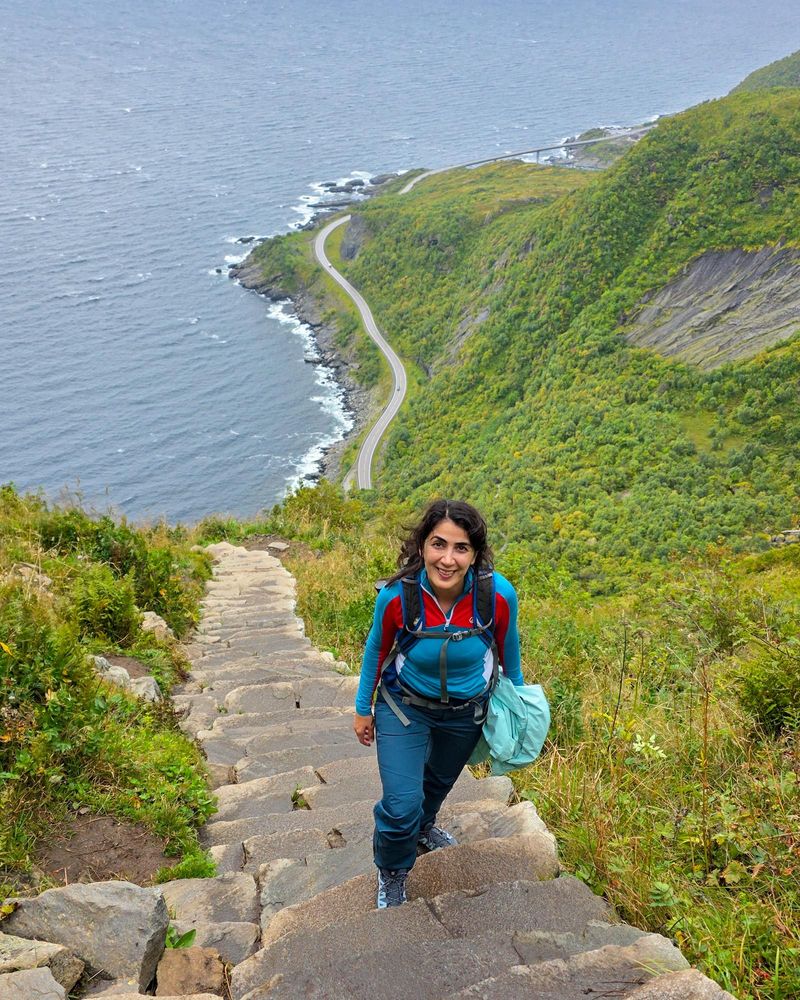
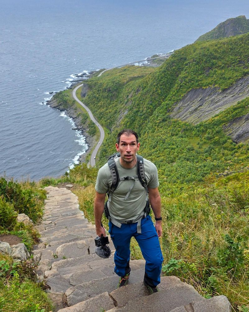
Reinebringen isn’t a technical hike, but it is considered a hard hike. What makes it difficult is how steep it is. I called it an infinity staircase in my video because every time I looked up and thought I could see the end, there were more steps. Some of them are quite high, and you’re climbing pretty much the whole way. Two kilometres might sound short, but your legs will feel it. There are benches along the route, so you can stop for a breather whenever you need one.
Coming down was quicker for us, but I found it just as demanding. The stone steps were wet from the rain, so I had to pay attention to where I put my feet. If you’re wondering whether this hike is right for you, think about how you’d feel coming down a long, steep staircase as well as climbing it.
What is the Reinebringen hike like?
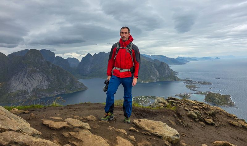
You follow the stone steps for most of the climb. When you reach the ridge, the view opens up over Reine and the fjord. I would have loved some sunshine for filming, but we could still see across the water and down to the village. After all those steps, I was very happy we could actually see it.
The viewpoint is exposed, and there’s limited room at the top. If you’re uncomfortable with heights, this is the section you’re most likely to feel it. You can carry on along the ridge beyond the main viewpoint, but the terrain gets more exposed and is better suited to experienced, sure-footed hikers. The main viewpoint already gives you the view you see in most photos of Reinebringen. On a wet and windy day like ours, I’d head back from there.
When to hike Reinebringen and what to bring
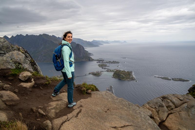
We went in August, and I’d still pack a waterproof jacket, waterproof trousers and waterproof hiking boots with good grip. I know it’s tempting to leave the trousers behind when you’re only going out for a couple of hours, but if it starts raining at the top, you still have the entire staircase to come down.
Take enough drinking water with you, as there’s nowhere to refill on the trail. May to September is the usual hiking season, but I’d look at the forecast and trail conditions before picking a day.
Where to stay near Reinebringen

You can also stay outside Reine and walk to the hike. We spent two nights in Reine at Husly Reine. I liked being able to walk to Reinebringen straight from the house. There were three bedrooms, which was more space than Bruno and I needed, so I’d especially consider it if you’re travelling with friends or family and can split the cost. My favourite part was the balcony. One thing to bear in mind is that our bedroom was upstairs and the bathroom was in the basement.
For a shorter stay as a couple, I’d look at May’s Apartments, which had a 9.5/10 guest rating on Booking.com. You’re in Reine and can walk to the hike, but you also have a kitchenette if you want to make breakfast or cook dinner. If you’d prefer a traditional fisherman’s cabin, Reine Rorbuer had an 8.7/10 rating. It’s also within walking distance of the hike, with restaurants and a supermarket nearby. The cabins vary, so it’s worth looking at the photos of the one you’d actually be booking.
You can also stay outside Reine and walk to the hike. Sakrisøy is one option if you’re happy with a longer walk via Reine. The Tide Rorbuer is a good option if you want to stay by the harbour and have a restaurant on site.
Camping near Reinebringen
If you’re travelling with a tent or campervan, Moskenes Camping is about 200 metres from the ferry terminal. It has tent and campervan pitches, showers and cooking facilities. From there, you can drive or take the bus towards Reine for the hike. Camping on Reinebringen itself is prohibited.
Where to park for the Reinebringen hike
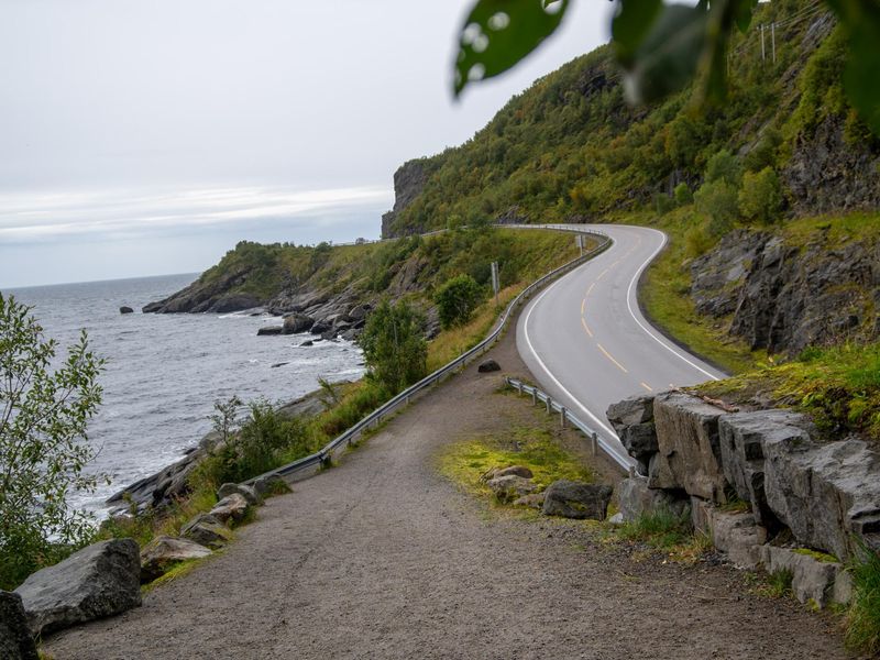
If you’re driving, park at Ytre Havn, the designated Reinebringen car park at Reine’s outer harbour. It’s about 1.9 km from the first steps, so put the car park into your navigation when you set off.
From the car park, walk through Reine towards Reinehalsen and follow the E10 in the direction of Å. When you reach Ramsviktunnelen, take the old road around the outside of the tunnel. That’s where you’ll find the start of the steps. If you’re coming by bus, Reine kryss is the closest stop to the trailhead.